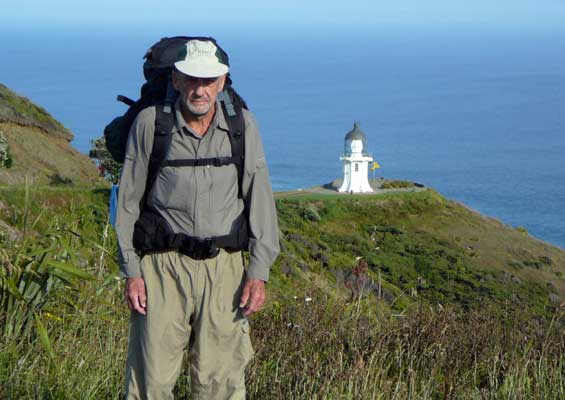
Bob Kennedy started his Te Araroa Trail walk from Cape Reinga in November 2010, a year before it was opened. This Te Araroa Trail blog is his story…
Te Araroa – The Long Pathway – Part 1
I started my walk from Cape Reinga (top of the north Island) to Bluff (bottom of the South island) on 29 November 2010. The Te Araroa Trail was officially opened a year later on 3rd December 2011.
My walk in summary…
Day 1: Cape Reinga Lighthouse car park to the Kahokawa Beach (top end of Ninety Mile Beach), 3.5 km short of the Te Paki Stream. This section is graded as tramping track. Distance 16.5 km, 6 hours.
Day 2: Kahokawa Beach to The Bluff on Ninety Mile Beach. Distance 22.5 km, 8 hours. All beach walking.
Day 3: The Bluff to Hukatere Lodge about 1 km south of the beach access point. Some track walking, mostly on the beach. Distance 33 km, 8 hours.
Day 4: Hukatere Lodge to Ahipara School. Distance 31 km, 8 hours. Total 104km.
Not sure how, when, or why this all started, but at least some of the thinking was that there were some tramping challenges close to home without the need to fly off to other parts of the country. It seemed a good idea to embark on a walk that was longer than usual and the end point far away.
I explored all the options of how to bus to the Cape and back again from Ahipara, but in the end Brenda took me to the Cape and waited for me to turn up at Ahipara.
Walking on my own was just a way of being able to alter my plans and even chicken out for whatever reason without upsetting anyone else. This section of the walk is best done at a time of midday low tides, and the going as far as Ahipara just right to gauge my interest in going further.
The need for a tent to camp out at least two nights, and warnings about the unreliability of potable water, had me carrying a 20kg pack when all four water bottles were full.
The risks of such a venture on ones’ own are minimal. I saw 5 trampers on day one, and numerous people and vehicles on the others.
Before leaving home I had copied the 1:50,000 map series and glued them into a 2 meter long strip. Added to this I wore a step counter with the notion that by counting my steps and referring to the map I could tell where I was. Most of the time it worked just fine so long as it was clipped to the top of my socks and not worn on the waist.
My step rate on the 21 km half marathon the week before had been 1260/km. But on the beach it seemed to vary between 1500 and 1600 depending on how soft the sand was, or more likely how tired I was. There are long stretches without any distinguishing features so it did give a clue, but didn’t really matter so long as the sea was on the right and the land on the left. It just helped the mind to cope with the pain.
I kept a notebook and recorded the events of day, each creek, and vehicle passing, etc (available on request), but the highlights are easier reading.
The night before I set out Penny scrutinised my packing list and I was pleased to be able to remove some items. She remarked that I seemed to be taking a lot of food. She said she loses weight when tramping. Didn’t seem like a good idea to me, and I did bring home surplus above what a 5th day would have used.


